What is a Watershed?
Purpose of Watershed Protection
Lake Huron Watersheds
Bi-National Partnership
Contact Us
Home > About
 Lake Huron is the second largest Great Lake by surface area 23,000 square miles, and the fifth largest freshwater lake in the world. It is the third largest of the Great Lakes by volume with 850 cubic miles of water. Its average depth is 195 feet and its maximum depth is 750 feet. Lake Huron is at an elevation of 577 feet above sea level. Lake Huron is 206 miles in length and 183 miles wide. When including the shoreline of its 30,000 islands, Lake Huron has 3,827 miles of shoreline, which is the largest of the Great Lakes.
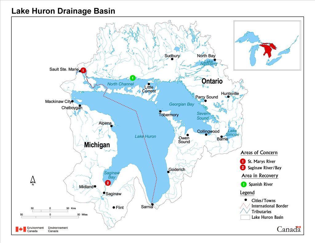
The drainage basin area of the Lake Huron Watershed is 51,700 square miles. Of that area, 16,100 square miles is in Michigan, and 35,200 square miles is in Ontario. Water drains from both Lake Superior and Lake Michigan into Lake Huron and then passes through the St. Clair River to Lake Erie. The retention time for water in Lake Huron is 22 years.
Sources: Environment Canada, EPA & Great Lakes Information Network
The Northeast Michigan Lake Huron Watershed Blueprint for Watershed Collaboration was established to promote collaboration between individuals, organizations, communities and agencies within the Watershed. Our goal is to inform residents about the importance of Watershed Protection and provide resources for education and action.
Northeast Michigan Council of Governments
80 Livingston Blvd. | PO Box 457
Gaylord, MI 49734
(989) 705-3730 | nemcog.org
![]()
![]()
![]()